As of version 7.04, there is an additional display of the current address in text form. This is either the actual GPS position (if the sensor function is "started") or the map center (if it is "stopped").
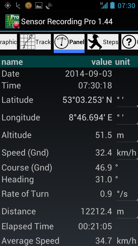
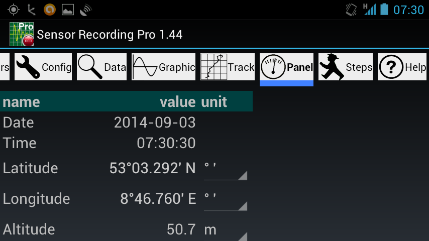
Since version 8.21 (if the device has a pressure sensor), the pressure data and a given QNH are used to calculate and show the altitude and climb rate as well. These data can also be displayed as a diagram in the "Graphic" menu.