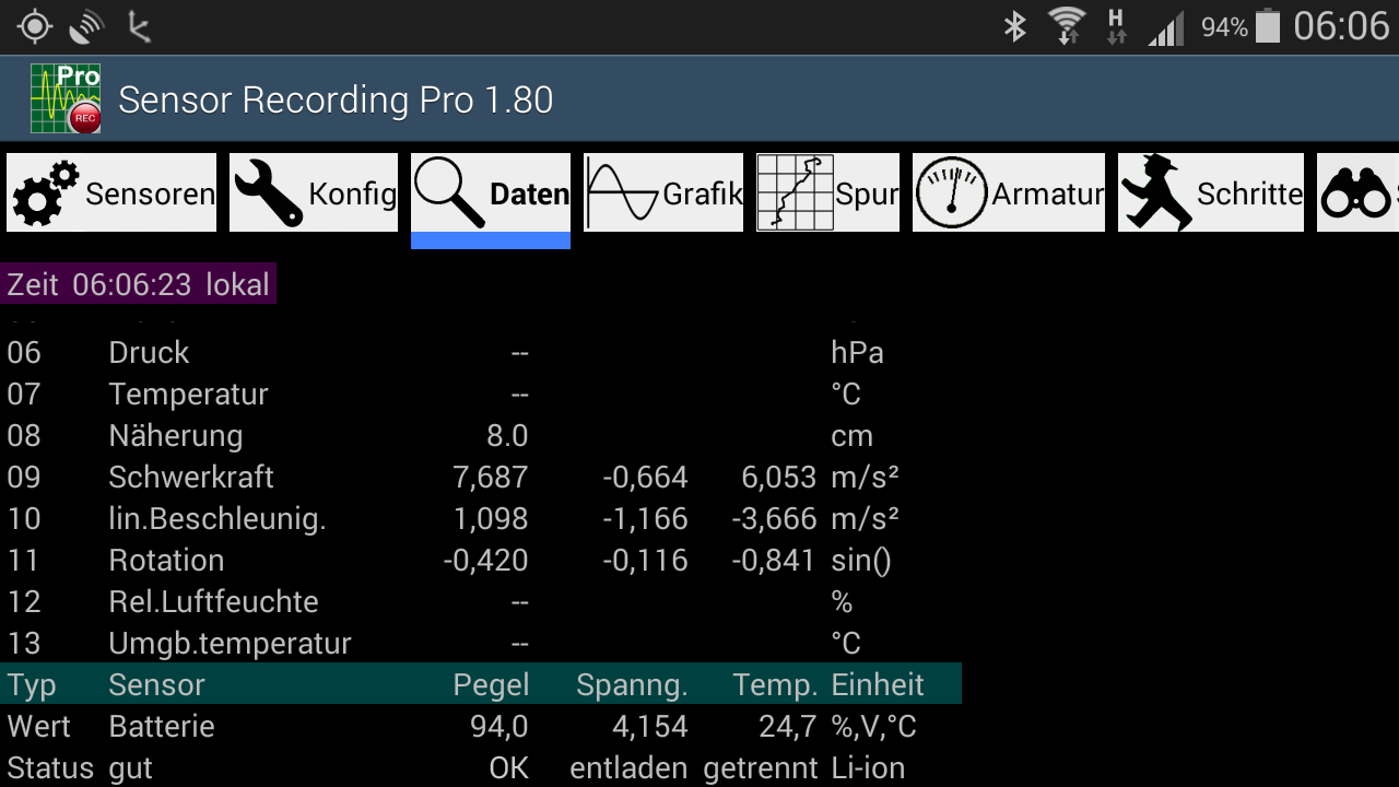
 in der Notifikations-Zeile angezeigt.
<?xml version="1.0" encoding="UTF-8"?>
<kml xmlns="http://www.opengis.net/kml/2.2">
  <Document>

    <Placemark>
      <Info>name;Sensor Recording;variant;Pro;version;1.54;code;28</Info>
      <Info>Start at 2015-02-13 06:59:16.422 +0100 (MEZ)</Info>
      <Style>
      <LineStyle>
        <color>0xff0000ff</color>
        <width>4</width>
      </LineStyle>
      </Style>
      <LineString>
        <extrude>0</extrude>
        <tessellate>0</tessellate>
        <altitudeMode>clampToGround</altitudeMode>
        <coordinates>

          8.7817395,53.0552003,0.0
          8.7817948,53.0552671,0.0
          8.7817973,53.0552485,0.0

        </coordinates>
      </LineString>
      <Info>Stop at 07:26:36.711</Info>
    </Placemark>

  </Document>
</kml>
    Bits  6 5 4 3 2 1 0
          | `---´ `---´
          |   |     |
          |   |    charge status (1=unknown, 2=charging, 3=discharging, 4=not charging, 5=full)
          |  charge plug (0=no plug, 1=AC, 2=USB, 4=wireless)
         screen (0=OFF, 1=ON)
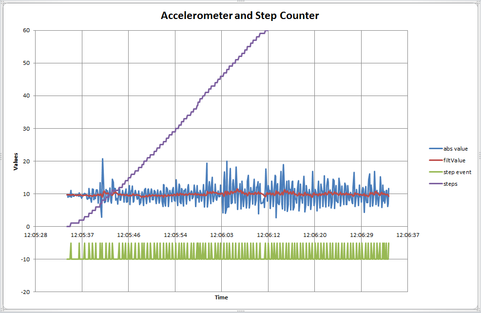
Die grafische Darstellung im Menü "Grafik" ist: